In the hills around Porto de Mós, central Portugal, an old railway route leads walkers through rock-cut passages, former train tunnels and landscapes overlooking the Lena Valley. Known as the Trilho da Porta do Vento, this hiking route combines industrial heritage with the limestone scenery of the Serra dos Candeeiros. Along the way, there is even a small woodland cabin hidden among oak trees.
What makes this walk particularly interesting is the history beneath its paths. Parts of the route follow a railway once used to transport coal from local mines. Infrastructure originally built for industrial trains has since become part of a landscape that walkers can explore.
The result is an unusual combination of mountain scenery, abandoned railway engineering and rural heritage, far from Portugal’s more familiar coastal walking routes.
From coal trains to a scenic walking route
Long before hikers began exploring this area, the hills around Porto de Mós were shaped by coal mining.
During much of the 1930s to 1950s, the former Bezerra railway line was used to carry coal from nearby mining operations towards a thermal power station. The railway was associated with the Couto Mineiro do Lena, an industrial mining district that once played an important role in the local economy.
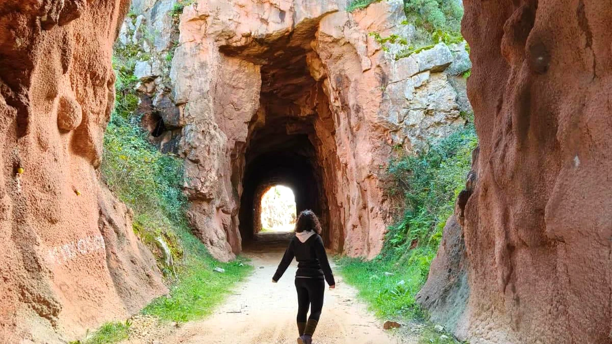
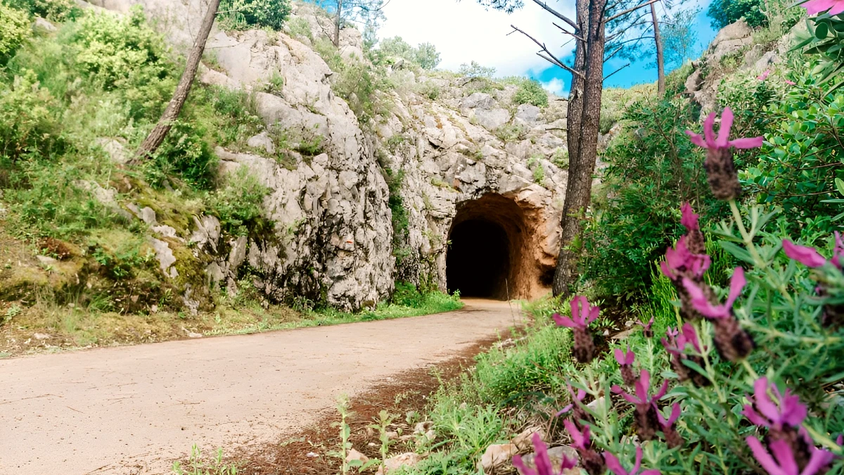
Building a railway through this mountainous terrain required substantial engineering work. Workers cut passages into the rock and created tunnels to allow trains to negotiate the uneven landscape.
These structures are among the most distinctive features that remain. The former railway corridor was later given a different purpose through the Ecopista da Bezerra, a route intended for walking and other non-motorised activities.
Where wagons once transported coal, visitors can now encounter traces of Portugal’s industrial history on foot or by bicycle.
The Trilho da Porta do Vento incorporates sections of this former railway environment. Its tunnels and rock-cut corridors are particularly memorable, revealing how an infrastructure built for industry has become part of the area’s outdoor appeal.
Porta do Vento: an opening onto the Lena Valley
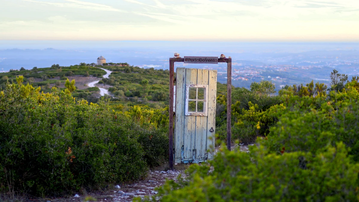
The landscape changes as the route moves away from the narrow railway cuttings.
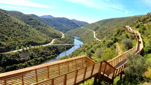
Some stretches open onto views of the Lena Valley, while others pass through more sheltered areas where vegetation grows close to the path.
The place known as Porta do Vento is associated with this contrast between enclosed passages and exposed mountain scenery.
Here, the wind and open views create a very different atmosphere from the former railway corridors. The transition is part of the walk’s appeal: one moment the route follows spaces carved by human activity, and the next it reveals the natural contours of the surrounding hills.
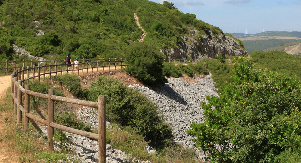
The wider Porto de Mós area is known for its limestone landscapes and its connection to the Serra dos Candeeiros. Rural tracks, rocky slopes and mountain viewpoints form the setting for a trail that also tells a story about the region’s industrial past.
Autumn can be an appealing season to explore the area, when temperatures may be more comfortable for walking. Conditions remain changeable, however, and the route’s main attractions — its tunnels, views and former railway structures — are not dependent on a particular time of year.
Cabana do Elias: a small cabin among the oak trees
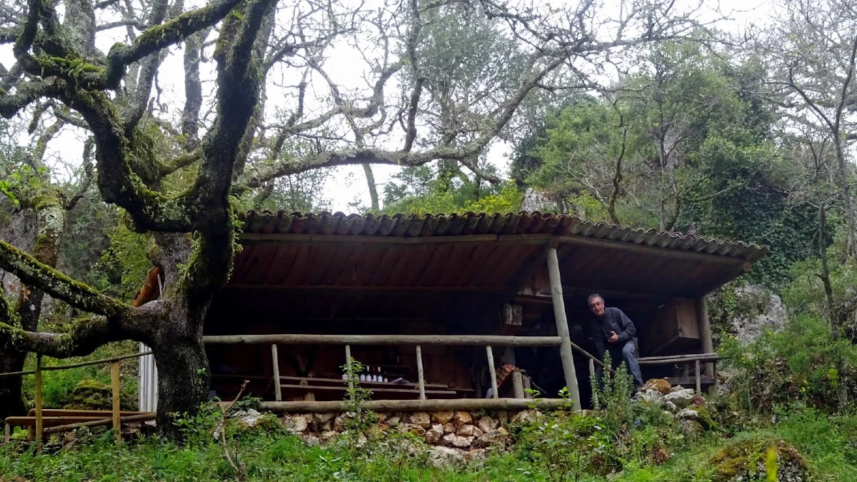
One of the more unusual places mentioned along the Trilho da Porta do Vento is the Cabana do Elias.
Set in a wooded area with oak trees, this small cabin provides a striking change of scenery after the open hillsides and rocky railway passages.
The appeal here is less about a major monument than the setting itself. Woodland replaces the exposed landscape, offering a quieter atmosphere and a potential place to pause and observe the surroundings.
However, the available description does not establish whether the cabin is publicly accessible or whether it has any official visitor facilities.
It should not be treated as a tourist accommodation or an open mountain shelter without further confirmation.
Other features of the route include traces of traditional rural life, such as old mills and mountain paths. Together, these elements reveal a landscape shaped by several different activities over time, not only coal mining.
An 11.5-kilometre hike with an important detail to check
The walk described in the available information covers approximately 11.5 kilometres, with a reported moderate level of difficulty.
That distance offers a useful indication of the outing’s scale, but there is an important distinction: the information does not confirm that the entire 11.5-kilometre route is a permanently marked public trail.
It may refer to a particular organised hiking itinerary rather than a fixed route with independently verified access throughout the year.
The precise starting point, expected walking time and any restrictions affecting individual sections have not been established.
Anyone planning to follow the trail should therefore obtain a reliable route map or GPS track and confirm local access conditions before setting out.
What to bring for the hike
Although the route is described as moderately difficult, rocky surfaces, exposed sections and changing weather can make preparation important.
Useful equipment includes:
- Walking shoes with good grip, particularly for stone and uneven ground.
- Enough drinking water for the expected duration of the walk.
- Food or snacks, as services may not be available along the route.
- A windproof layer, especially for exposed viewpoints.
- A fully charged phone and a reliable offline map.
- A torch, if the confirmed itinerary includes tunnels without adequate lighting.
Former railway structures deserve particular caution. Visitors should respect any access restrictions and avoid entering tunnels or other abandoned infrastructure unless their accessibility and safety have been confirmed.
Where is Porta do Vento, and how can you visit?
Porta do Vento is associated with the area around Porto de Mós, in Portugal’s Leiria district, within the country’s central region.
The wider landscape combines the limestone hills of the Serra dos Candeeiros, traces of former mining activity and sections of railway infrastructure adapted for recreational use.
For visitors interested in exploring Portugal beyond its major cities and beaches, the route offers a different perspective on the country’s heritage.
Rather than visiting a single monument, walkers can discover how industrial engineering, rural traditions and natural scenery intersect in the same landscape.
The most practical starting point for planning a visit is to check the route with local tourism services or the organisers responsible for the particular hike.
The advertised 11.5-kilometre distance should not be taken as confirmation that every tunnel, path or woodland site mentioned is permanently open to the public.
With a verified itinerary and suitable preparation, the Porta do Vento area offers an intriguing opportunity to discover a lesser-known side of central Portugal, where the remains of a coal railway have become part of the mountain landscape.